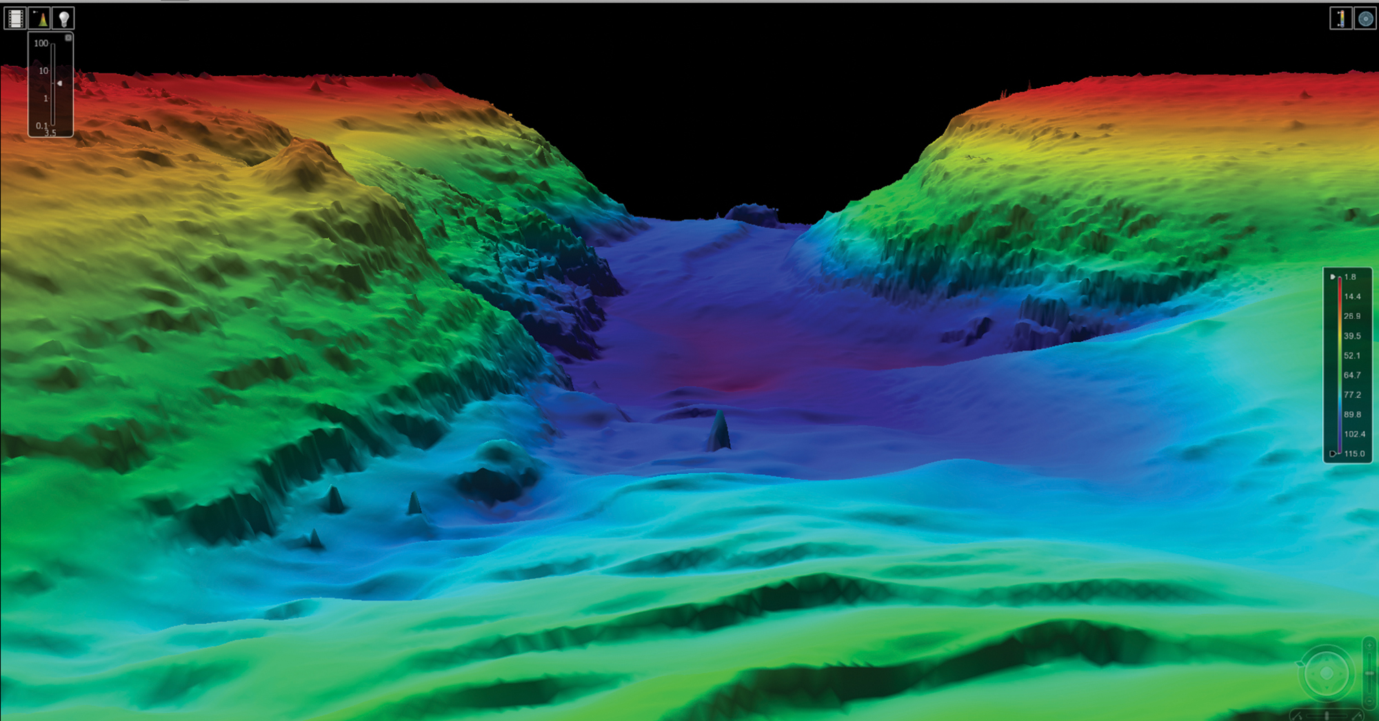
Mapping the Sea Floor with Lasers
The next step in mapping, LiDAR utilizes high-tech lasers to give us the most accurate maps yet.


The next step in mapping, LiDAR utilizes high-tech lasers to give us the most accurate maps yet.
Two researchers mathematically prove the longest navigable straight path on earth.
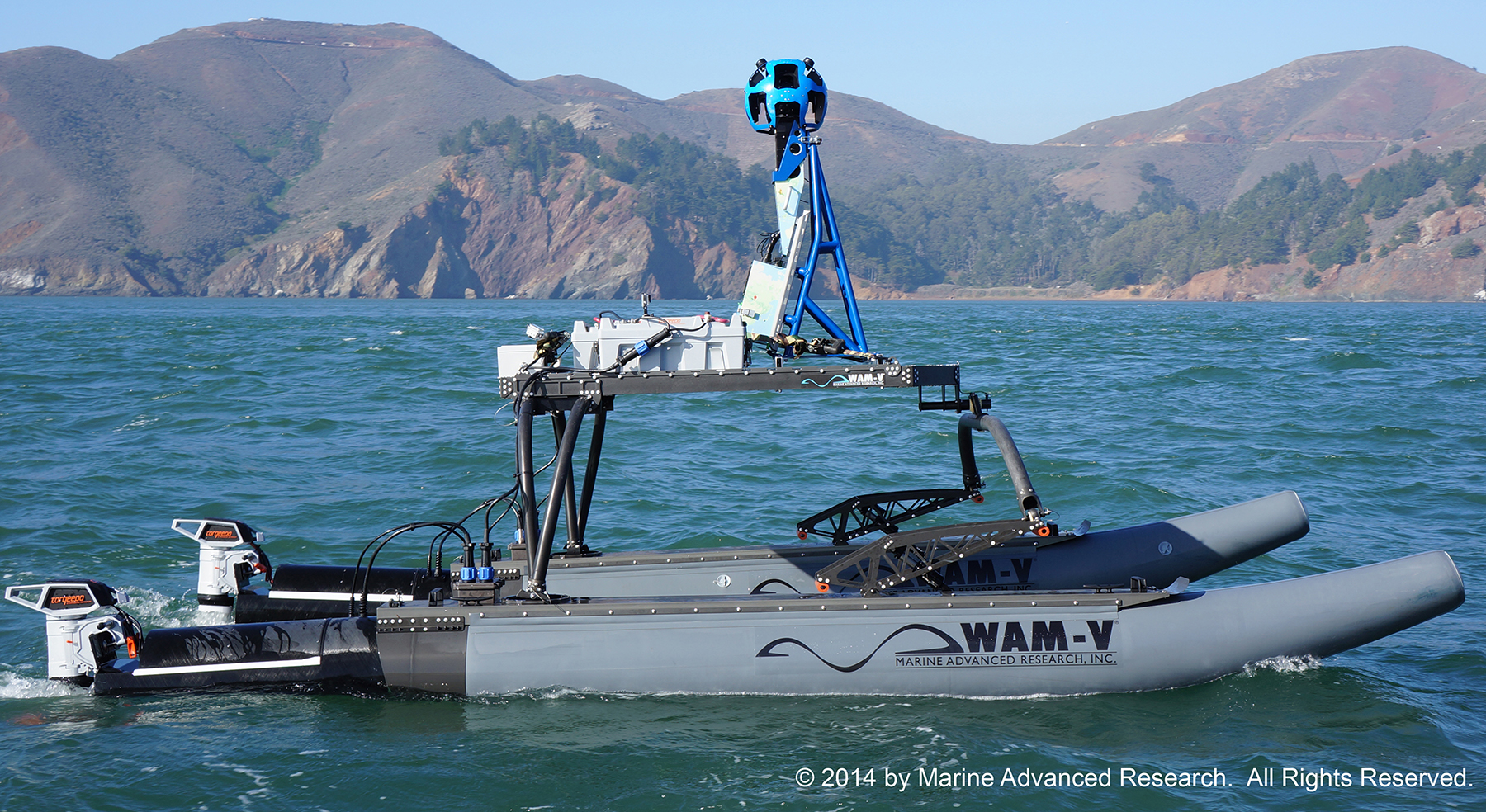
With the help of Google, Torqueedo electric power, solar panels, and a specially designed multihull boat, the Baykeeper project is hard at work photographing some 500 miles of coastline around the San Francisco Bay area.

The crew of Celt, a Nordhavn 43, explore Australia and Indonesia on their multiyear circumnavigation.

All the right things, in all the right places.

Bearings from the Editor’s Desk

Devising a safe, easy way to get our dog on shore from an anchorage required some innovation.

Before you go to sea, know how to access telehealth services, acquire medication refills and get medical care.

Planning for loss of steering and engine control requires familiarity, not new equipment.

A set layout is paired with an impressive list of standard equipment on a proven hull design.

When you can’t go any faster or slower, there are other options to help you arrive safely.

Let’s bring back these nautical words and terms. They’re better than the way we communicate today.

Once a rescue craft, this Norway-built steel trawler is the ticket to ride for a venturesome crew.


