

I can see how AI is so trusted. The language it uses mimics human qualities that confer safety, authority and, most of all, reassurance.
Executives are rewriting emails. Writers are sharpening phrases. Cooks are improving recipes. Mechanical problems are being solved. And the list goes on and on.
In the past, whenever I had to read a medical report, I would have to look up every other word with a medical dictionary in my hands. Today, I just cut and paste the report into AI and ask it to translate into plain English. One of my doctors recommended the same for her mother.
I also create custom birthday cards for my grandchildren, putting their storybook likeness into action scenes, and then printing the result on cardstock. I am really enjoying AI.
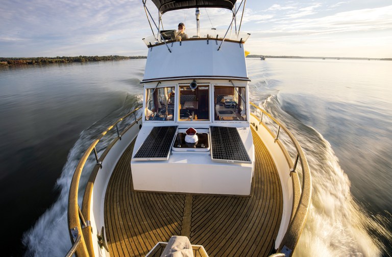
So, I thought it also might be good to use on the boat. Our Tollycraft (see “Living off the Grid” at passagemaker.com) winters in Staten Island, N.Y., and we spend the warmer months on a mooring on the North Fork of Long Island. Generally, I turn to my Navionics app on my iPhone to check the currents. Hell Gate, and the area just west of Roosevelt Island, can be a challenge for a trawler, as those currents can reach 4 knots.
Steerage can be difficult for me, and especially for the numerous tankers, barges and fast ferries utilizing these waters. I can’t predict the weather a month away, but thanks to my iPhone and some middle-of-the-night navigation, I can plan ahead and find the window or windows of opportunity for my safe journey.
After finding an appropriate three-day period in May, I decided to see if AI might be useful. First, I asked it to pick the best time to leave from Great Kills Harbor to Northport on May 3, according to the tides and currents at Hell Gate. The answer: “Great question—and you’re thinking about it exactly the right way. Hell Gate timing makes or breaks this trip.” There it was, the reassurance and confidence.
It went on to give specific timings and periods of high tide and currents, and an area-by-area analysis. It matched my research and departure time. It also asked if I wanted a “full waypoint plus ETA plan to Northport.”
When I said yes, it answered, “I’m going to give you a real captain-level passage plan with waypoints, legs, ETAs and current strategy—built specifically for May 3, 2026 and your 8-knot cruise.” That sounded so professional. Leg by leg, coordinates and timing were all laid out.
I asked for a downloadable GPX file to upload into my Navionics app. It turned out that the route was only waypoints. A bit disappointing, but correctable. In all fairness, it also told me to “load NOAA charts or a Garmin chart overlay and verify: buoy positions (they shift) and any temporary restrictions.” That was the only caveat AI warned me about at this point.
When I asked for a route, not just waypoints, AI said “good catch” and created a “safe deep water route” and a “tighter optimized route.” Every time AI gave me a GPX file, I imported it into my Navionics app.
Once I looked at each route, I realized this wasn’t working. Many of the waypoints were on land, even though I had asked AI for a route that would keep me safely in channels and out of danger. A few iterations later, the results were different, but still crossing on land. Finally, I said that any route taking me over land should not be tolerated, and AI told me it would fix the problem. It said I should use the auto-guidance feature on my app, or it would rebuild the file “accurate and usable.” That never happened.
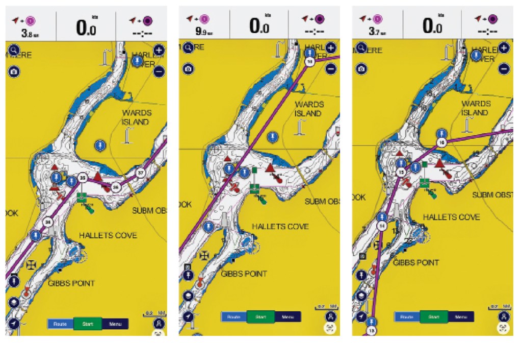
Eventually, I looked at three routes through Hell Gate taken from my Navionics app. The first (far left) is a route that I plotted, manually, by using my knowledge. The second two (middle and right) are AI-generated. My manual route has taken me safely to and from Northport dozens of times. It follows all the navigable waters and channels. AI’s first attempt routed me up the FDR Drive, which runs along Manhattan’s east side, then across Wards Island. AI’s third attempt, after I pointed out the obvious dangers of a land-based route, wasn’t any better.
Obviously AI is not ready.
If my 61 years of boating has taught me anything, it’s that the captain’s responsibility is to keep the vessel and crew safe. Boat owners purchase radar, GPS, depthfinders, AIS and so many gizmos with the expectation that they will help prevent problems underway. I also inform the guests and crew of certain rules that have to be followed, to ensure everyone’s safety.
I can see how people would turn to AI for help on the water, but if they rely on it for navigation, they will likely have a major problem. I can only imagine the impatient boater uploading a route without checking all the details, only to find while underway how big a mess they have on their hands. That’s not the time to start plotting your course.
This article originally appeared in the July/August 2026 issue of Passagemaker magazine.