There’s a particular kind of confidence that comes with running familiar waters.
It settles in over time. The markers are the same, and the shoreline feels known. The chartplotter may even show a track you’ve followed before. And yet, along much of the U.S. coast, especially in sounds, bays and inlets, the bottom doesn’t share that confidence. It moves.
Sand shifts. Channels migrate. Shoals build where open water once was. What was safe water last season can become a problem this season, and sometimes sooner than that. Groundings in these waters rarely happen because someone didn’t know better. They happen because someone assumed what was true before is still true now.
It’s an easy mistake to make. We rely on charts, largely electronic versions today, to give us a picture of the world beneath us. But in dynamic coastal environments—places like the sounds of North Carolina, the shifting bars of Florida’s Gulf Coast or the broad, shallow bays along the Eastern Seaboard—those charts are, at best, a snapshot in time. Even with regular updates, they can lag behind.
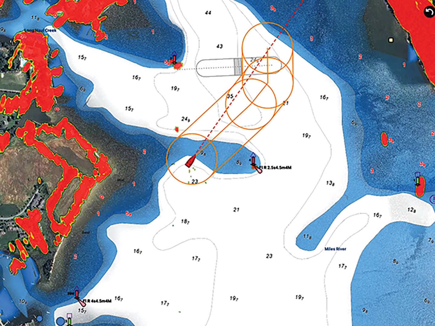
Modern charting apps attempt to narrow that gap. One popular app incorporates the latest U.S. Army Corps of Engineers dredge surveys as color overlays, showing the most recent depth data in waterways and inlets the Corps maintains. Another charting app layers in crowd-sourced soundings from boaters, offering a real-world picture of depths actually being experienced.
These are valuable tools, but they don’t change the nature of the environment. They simply give you a more current starting point.
The problem isn’t the chart. The problem is how it’s used.
A chart should be treated as a guide, not a guarantee. It tells you where the bottom has been, not necessarily where it is today. When we forget that, we begin to substitute trust for awareness. We stop asking the important questions that keep us safe: Is that channel still where the chart says it is? Does that buoy actually mark the edge of safe water? Or has it shifted?
In many coastal areas, aids to navigation are moved as conditions change, but not always as quickly or precisely as we would like. A buoy can be “on station” and still not perfectly aligned with the deepest water. Storms, currents and even normal seasonal changes can alter the seabed faster than the U.S. Coast Guard can reposition the markers.
And then there’s the matter of tide. In places where depths are already questionable, tide may be necessary for a margin of safety. A rising tide can carry you over a shallow stretch that would have stopped you cold an hour earlier. A falling tide can turn a safe passage into a grounding in the span of a single transit.
But “deep enough” is rarely precise. If your draft is 4 feet and the chart shows 5, that single foot of clearance can disappear quickly with a slight error in position, or a tide that is lower than predicted. Add a bit of squat as you increase speed, and the margin you needed is gone.
This is where boat handling becomes less about control and more about judgment. Speed, for example, plays an important role in shallow water. There is a point between idle speed and fully on plane when most boats’ sterns settle deeper into the water. It’s not dramatic, but it’s real, and in tight margins, it matters. Slowing to idle speed reduces squat, gives you more time to read the water, and makes it easier to respond when something doesn’t look right.
Often, the first indication of trouble isn’t on the screen. It’s outside—say, a change in water color. A ripple pattern that doesn’t match the wind. A line of breaking water where none should be. These are the subtle signals that the bottom is closer than you think.
These signs are easy to miss if your attention is fixed entirely on the chartplotter. It’s a powerful tool, but like any tool, it narrows your focus. You begin to steer to a line on a screen rather than to the water around you. And that’s where the disconnect happens.
Good boat handling in these environments requires a broader kind of awareness, one that blends what the instruments are telling you with what your eyes and instincts pick up in real time. It’s less about following a track and more about interpreting a submerged landscape that is constantly changing.
It also requires a willingness to question your assumptions. If something doesn’t look right, it probably isn’t. Set your shallow-water alarms to give yourself time to act early. Slow down. Alter course. Give yourself room to reassess. There’s no penalty for caution in shallow water. There is, however, a cost to hesitation.
And when a grounding does happen—and sooner or later, for most of us, one will—it’s rarely dramatic. There’s no sudden impact, no violent stop. More often, it’s a gentle but unmistakable deceleration, followed by the realization that forward motion has stopped. What happens next depends on how prepared you are.
In many cases, the best response is patience. A rising tide may solve the problem without further effort. If not, backing off along your approach track is often the safest move, assuming you’ve come in slowly and deliberately. Powering ahead rarely improves the situation and can make it worse.
Our primary focus here is not how you get the boat off the bottom. It’s how you got there. Groundings in shifting coastal waters are not usually the result of a single bad decision. They are the result of a series of small assumptions: that the chart is current, that the buoy is accurate, that the tide is sufficient, that your boat is actually where you think it is.
Individually, each assumption feels reasonable. Together, they can lead you onto the bottom.
The alternative is not to abandon these tools or ignore your experience, but instead to use both with a bit more humility. To recognize that in places where the bottom moves, certainty is always provisional. You may have known these waters last season. But do you know them today?
This article originally appeared in the September 2026 issue of Passagemaker magazine.